In five minutes
The Lewis and Clark Expedition (1804–1806) was the first overland journey by U.S. citizens to the Pacific coast and back. President Thomas Jefferson sent Meriwether Lewis and William Clark, with a crew of about thirty-three, up the Missouri River, across the Rocky Mountains and down the Columbia River. Their goals were to find a water route across the continent, map the land, record plants and animals, and open relations with the Native nations they met.
They left near St. Louis in May 1804 and came home in September 1806, after roughly 8,000 miles. They found no easy water passage. They did produce detailed maps, hundreds of scientific descriptions and the first official U.S. contact with many Native nations of the West. The trip also prepared the ground for traders and settlers, with heavy consequences for the people who already lived there. The expedition is one chapter in the story told on the hub page 19th-Century America: Expansion, Civil War and the Gilded Age.
Why Jefferson wanted to explore the West
Jefferson had wanted an expedition to the Pacific for years. He believed a river route might link the Missouri to the Columbia, which would give American merchants a path to trade with Asia. He was also curious about the West's geography, animals and peoples, and he feared that Britain or France would claim the region first.
In January 1803 Jefferson asked Congress, in a confidential message, for money for the journey. Around the same time his diplomats in Paris were negotiating with France. In April 1803 they signed the treaty known as the Louisiana Purchase, which roughly doubled the size of the United States for about $15 million. The expedition began as a plan to reach the Pacific and was now also a survey of newly bought land, much of which was home to Native nations who had never agreed to be part of the United States.
Jefferson picked his private secretary, Meriwether Lewis, an army officer who knew the frontier. Lewis invited William Clark, a skilled mapmaker and river man, to share command. The two men worked as equals in practice, and the group became known as the Corps of Discovery.
The journey out, 1804–1805
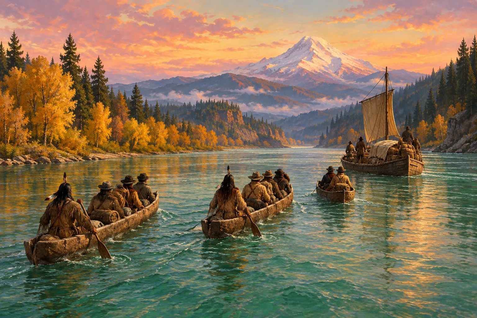
Lewis spent the summer and autumn of 1803 gathering supplies and a keelboat, then met Clark and the first recruits and wintered at Camp Dubois, across the Mississippi from St. Louis. On 14 May 1804 the party set out up the Missouri River. They moved slowly, pulling and poling a heavy boat against the current, and kept detailed journals of everything they saw.
In August 1804 Sergeant Charles Floyd died, probably of a burst appendix. He was the only member of the party to die on the whole journey. A few weeks later the group had a tense meeting with the Teton Sioux (Lakota), a powerful nation on the river. Both sides showed force, and the meeting ended without a battle.
The party reached the Mandan and Hidatsa villages in what is now North Dakota in late October 1804 and built Fort Mandan for the winter. There they hired a French-Canadian trader, Toussaint Charbonneau. His wife, Sacagawea, a young Shoshone woman, came too. She gave birth to a son in February 1805 and travelled with the baby. Her knowledge of the Shoshone language and her presence made the group look like a peaceful party, not a war party.
In April 1805 the expedition left Fort Mandan and continued up the Missouri. In June they reached the Great Falls of the Missouri, which forced a slow, exhausting portage of several weeks. In August Lewis crossed Lemhi Pass over the Continental Divide. He expected to see an easy descent to the Columbia. Instead he saw more mountain ranges.
The Shoshone were now essential. Their chief, Cameahwait, turned out to be Sacagawea's brother. The party traded for horses, which they needed to cross the Bitterroot Mountains.
Across the mountains to the Pacific
The crossing of the Bitterroots in September 1805 was the worst stretch of the journey. Snow fell, game was scarce, and the men ate horses and candles to survive. When they came out onto the Weippe Prairie, the Nez Perce gave them food and helped them build canoes. The party then moved down the Clearwater, Snake and Columbia rivers.
In November 1805 they reached the lower Columbia and the Pacific. Clark wrote in his journal that the ocean was in view, though they were still in the river's wide estuary. In late November the whole group, including Sacagawea and York, an enslaved man who belonged to Clark, took part in a vote on where to spend the winter. They chose the south side of the river and built Fort Clatsop, near present-day Astoria, Oregon, named after the Clatsop people who lived nearby. The winter was wet and miserable, but the men traded with the Clatsop and Chinook, wrote up their notes and drew maps.
The return, 1806
The party left Fort Clatsop on 23 March 1806. After crossing the Bitterroots again, they split in July so that Lewis could explore the Marias River and Clark the Yellowstone. During Lewis's trip, a fight with a small group of Blackfeet left two Blackfeet dead, the only violent deaths of the journey. In August Lewis was accidentally shot in the thigh by one of his own men, Pierre Cruzatte. The two groups reunited on the Missouri. They dropped off Sacagawea and Charbonneau at the Mandan villages in August, then raced downriver with the current and reached St. Louis on 23 September 1806. The town had given them up for lost.
What the expedition changed
The expedition did not find a Northwest Passage. It showed instead that no easy water route existed, because the Rockies were too wide and too high. This ended a long-held hope and changed American thinking about trade across the continent.
It was a great success in other ways. Clark's maps shaped how Americans saw the West for a generation. The journals describe well over a hundred plants and animals that were new to science, along with the languages, customs and trade of dozens of Native nations. The journals were published in an edited form in 1814, and later in full.
The long-term effects were political. The trip supported U.S. claims to the Pacific Northwest, which was later disputed with Britain, and the Oregon boundary was settled by treaty in 1846. Fur traders followed the route first, and settlers in the Oregon Trail era followed later. For Native nations, the expedition was an early sign of the pressure that came with American expansion, which ended in lost land, disease and forced removal. The same westward growth also raised the question of whether slavery should spread into new territory, a conflict that led to the Civil War and the world of Abraham Lincoln.
The leaders had mixed fortunes afterwards. Lewis became governor of Louisiana Territory in 1807 and died in 1809 from gunshot wounds, in circumstances historians still debate. Clark became a federal Indian agent and later governor of Missouri Territory.
What exams ask
- Link it to the Louisiana Purchase. Expect questions on how the 1803 purchase led to the 1804–1806 exploration of the new land.
- Goals and results. Know the aims (a water route, maps, science, diplomacy and trade) and that no easy route was found.
- Role of Native peoples. The Mandan, Shoshone and Nez Perce supplied food, horses and guidance; Sacagawea helped as an interpreter and as a sign of peaceful intent.
- Significance (AP style). Explain how the expedition supported U.S. territorial claims and later westward expansion, and how that affected Native nations.
Read next
- The Louisiana Purchase (1803): the land deal that made the expedition necessary.
- The Monroe Doctrine (1823): how the United States defined its role in the Americas once it had grown westward.
- Who Was Abraham Lincoln?: the president who led a country that expansion had divided.